


Rolling Homes and Sinking Ships: A Summer Adventure Stopped Short Amid Uncertainty
Plus, How a Cartographer’s Rendering Inspires Nova Scotia Ambitions

After Sarah and I set our sights on Maine as the destination for the camper van this past summer, we lifted our gaze and saw another option further afield.
Nova Scotia.
The idea was to, first, get to Maine obviously. Beyond that, though, we wondered: What if we kept going? What if we kept going all the way to and around Nova Scotia? What if we kept going all the way to and around Nova Scotia and then put the dogs and ourselves and the camper van on a ferry boat back to Maine?!?
Yes, we said, that was it. That was the plan.
But — you knew it was coming, and so did we on some level because “buts” are what happen when you make plans — Mother Nature intervened. The wildfires in Canada during the summer stirred caution in us. Was it irresponsible to travel so aggressively into Canada during the crisis? What if we needed help while traveling, would that take help away from those who really needed help?
It is not an uncommon thing for me, a cautious-by-nature person, to respond cautiously. But when the intrepid, spontaneous half of my relationship suggested that we alter the plan in favor of a more cautious itinerary, it was unsettling.
Yes, of course, we said. We will change the plan.
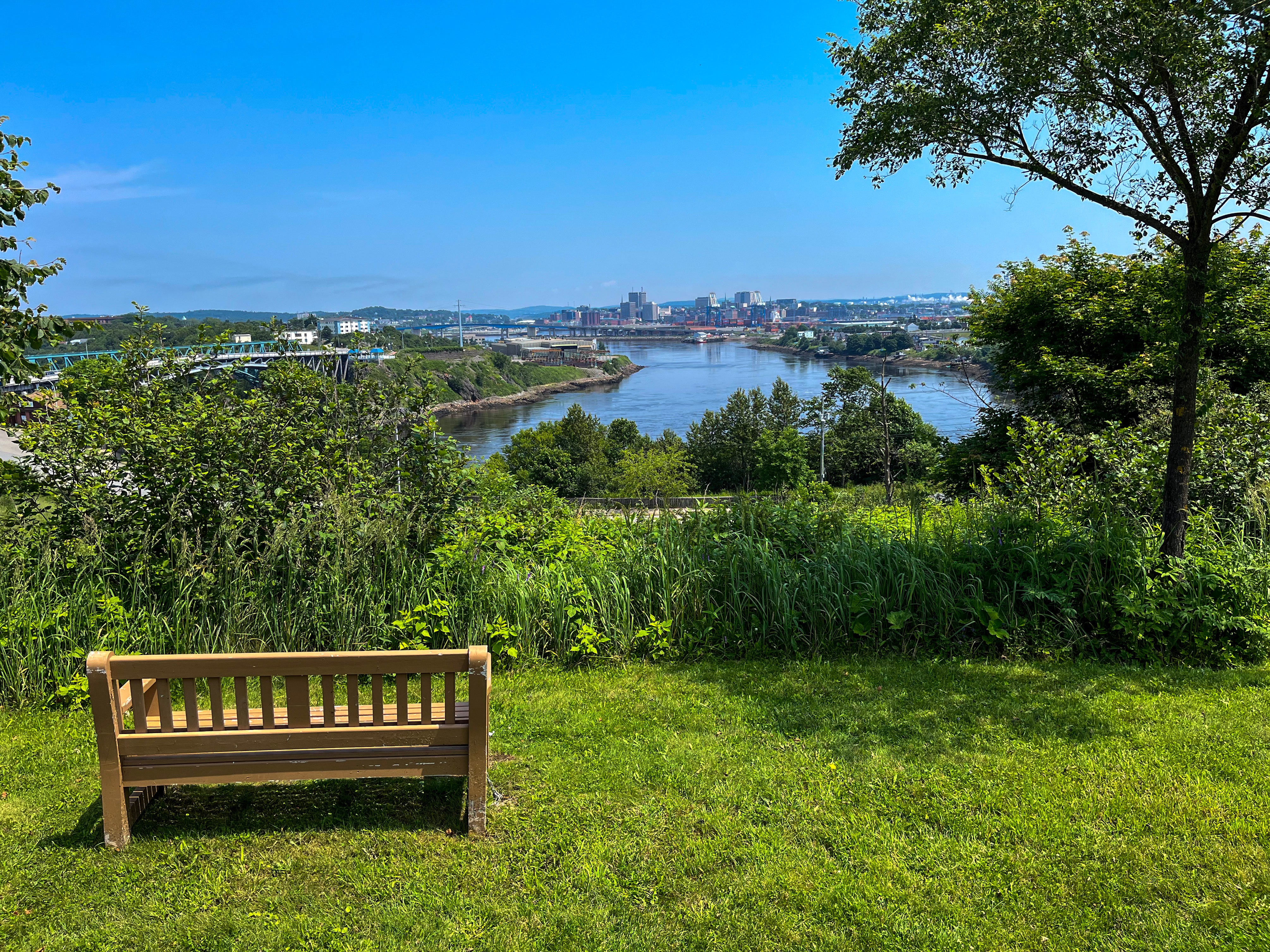
So we proceeded with caution. We arrived in Maine and we did keep going, stepping into the New Brunswick territory of Canada for a few days. We traced the western shore of the Bay of Fundy up from Saint John to Mispec to St. Martins before pivoting back toward home.
It was a scaled back itinerary and one that, in the end, keeps Nova Scotia in our sights for the future. We have to go back to go again for the first time. To witness the dramatic tide swings, which sounds boring until you watch the tides along the Bay of Fundy with your own eyes and, man, are they wild, as wild as slow-moving water could be.

Also to see the place the Acadians (from France) called home (after the Mi'kmaq) before they were forced back to France (by the British) only to leave once again (with the help of the Spanish) for a more southern home (Louisiana) that is familiar to Sarah and I (Louisianians)1.
And perhaps most importantly, to put the damn van on that damn ferry because how cool would it be to park your rolling home on a boat and cruise from one country to another country???
Well, about that, and here comes my cautious nature …
Nova Scotia is infamous for shipwrecks.
To wit, “Shipwrecks of Nova Scotia”, a map made by cartographer Peter Atwood, is a lovely demonstration of Nova Scotia’s penchant for sinking ships.
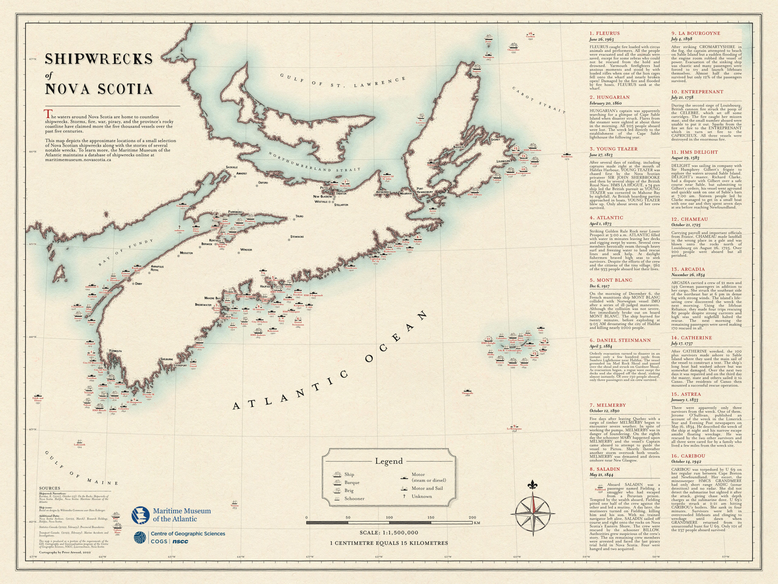
Not only is it a good-looking map — note the simplicity of the color scheme, the yellowing look of the “paper”, the Fleur-de-lis as north arrow, the stylized little ships — but it is a map that invites further exploration by way of the numbered ship stories along the right-hand side of the page. Which, given the subject matter, is fitting. Setting sail for distant shores is, in large part, about exploration after all.
Atwood’s cartographic execution is award-winning and proof that there can be a lot to see in a simple, minimalist package. In fact, it could be that the closer you get to simplicity, the more there is to talk about. If that is true, then Atwood’s map is a textbook example and worthy of further study.
Just like Nova Scotia is worthy of further visit.