A Cartographer's Homage to National Park Service Maps: The Stunning White Mountains Map by Andy Woodruff
Discover the inspiration and methodology behind the creation of a timeless map for visitors to New Hampshire's White Mountains
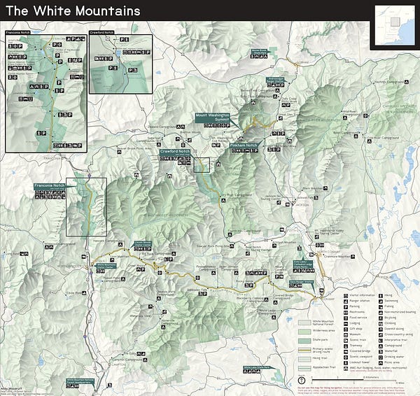
Boston cartographer Andy Woodruff released a stunning map of New Hampshire’s White Mountains in the style of a National Park Service visitor map:


Andy is a well-known modern cartographer in cartography circles. Woodruff’s Daylight Saving Time map and methodology makes the rounds on the internet this time of year and is something of a viral sensation at this point.
This map, though, is a detour from the scientific and interactive. It is a foray into something a little more old school and timeless.
My quest, as means to get back into practice with print-style mapping, was to attempt a map that a casual or first-time visitor to the White Mountains might find useful. This was a "copy the masters" type of exercise, taking symbols and a lot of other design elements directly from NPS maps, which are freely available, assets and all.
This type of exercise is near and dear to my own heart, in fact. A long, long time ago at a blog far, far away, I wrote about imitating data visualization and cartography styles that you admire as a great way to practice your own skills in those disciplines.
Andy’s White Mountains map is orders of magnitude better than my own offerings, which means I get to look toward this map now as a source of inspiration the next time I fire up QGIS for a similar project.
Andy does a great job of not only creating the map, but also telling the story behind the map. On Woodruff’s website you can read more about the process behind the White Mountains map. Here you also can view the full-sized map.


